
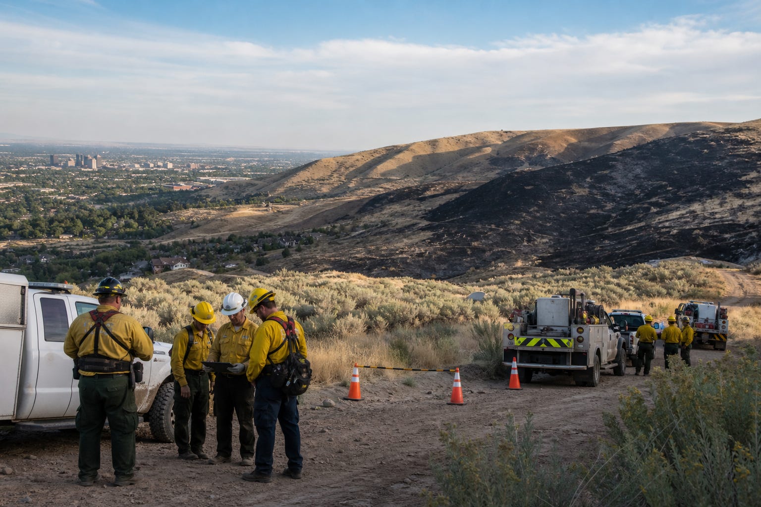
Fire commanders pulled crews back from the Claremont Fire on July 13 after the U.S. Army Corps of Engineers warned that intense heat could trigger old military ordnance beneath the Boise Foothills. By that point, the fire had burned 6,805 acres. Firefighters returned later that day, but only after operations moved outside a designated danger zone.
No unexploded round was reported during the fire. The threat still changed how crews could protect nearby homes and public land. A military range created more than a century ago had become a present-day public safety limit.
The old range reaches into modern Boise
An official Army Corps fact sheet describes an 8,570-acre Munitions Response Site that includes the former Boise Army Barracks and surrounding ground. Part of the site lies inside Boise. Federal mapping places its nearest edge within a mile of downtown, with the footprint extending about five miles into the Foothills. Its southern side approaches the East End and Boise Heights neighborhoods.
The Army established Fort Boise at the site in 1863. Military use continued through World War II, including Idaho National Guard field and artillery training during the first half of the 20th century. The land is now divided among the Bureau of Land Management, the U.S. Forest Service, the City of Boise, trail managers and private owners.
Federal investigators split the response site into four sectors. One 3,089-acre sector includes the historic main target area for 75-millimeter artillery. Another 4,283-acre sector covers maneuver ground and part of the same firing range. The list of possible remnants includes artillery projectiles, mortar rounds, shrapnel shells and practice anti-tank devices. There is no complete count of what was fired or what failed to detonate.
Officials have stressed that established roads and trails were cleared by the military and are considered safe for travel. That distinction matters. A familiar trail can be open while nearby off-trail ground remains part of a federal munitions investigation.
One fire narrowed the crews' choices
Boise Fire said at the start of the Claremont incident that personnel could not safely enter some sections of the Military Reserve. The department joined a unified command with the Bureau of Land Management and adjusted its suppression plan around the mapped hazard.
After the July 13 pause, the Army Corps recommended an 1,800-foot safety buffer around the former firing range. Crews resumed work beyond that line. Helicopters, engines, dozers and hand crews remained active, while containment work shifted farther east toward an old logging road.
Aircraft face a separate constraint over some contaminated ground. Federal guidance calls for planes to remain at least 1,500 feet above the surface because heat, flames and the force of water or retardant drops could disturb old rounds. At that height, water and retardant spread too widely to work as effectively. The result is a smaller tactical toolbox when dry grass and wind are already pressing firefighters.
The public effects did not end with containment. The Bureau of Land Management reduced its closure area on July 20, reopening several trails, but kept other roads and trails closed for suppression, emergency stabilization and rehabilitation. The updated order is scheduled to remain in place through August 1 and does not apply to private land.
Federal cleanup is moving, but it is not finished
The Army Corps cleared the surface of roughly 1,000 acres in 2002 and removed a 75-millimeter projectile. Later fieldwork in 2019 and 2020 located another 75-millimeter projectile and an anti-tank practice mine near trails. A federal review completed in 2023 found explosive risks serious enough to require development of additional remedies in both heavily used and lightly used areas.
The latest federal reporting says no new munitions have been found since 2020 and that prior removal work has reduced danger. Investigators have used visual surveys, magnetometers, subsurface searches, soil sampling and off-site disposal when potentially hazardous items were discovered.
The process still has several formal steps. The Army Corps must finish evaluating cleanup alternatives, present a proposed plan, select a remedy and carry it out. Options can include more surface or underground removal as well as limits on how certain land is used. Federal reviewers have also identified a basic communication problem: warning signs have not followed one standard, and their locations have not been kept in a complete catalog.
Those records give Boise residents concrete accountability markers. The next phase can be judged by whether the federal government produces clear maps, consistent signs, dependable firefighting rules and a schedule for the selected remedy.
Trail users have a simple safety rule
The Army Corps tells anyone who encounters a suspicious military object to follow three steps: recognize, retreat and report. Do not touch, move or disturb it. Leave by the same route without running, then call 911 and tell law enforcement what was seen and where. Trail users should also obey posted closures even when a neighboring route has reopened.
The Claremont Fire exposed the operational price of unfinished work: wider safety buffers, weaker aerial drops, closed public land and fewer choices for crews protecting property. The next federal decisions will determine whether Boise carries that cost into future fire seasons.